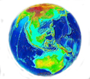
Global Bathymetry Model

Bathymetric information is traditionally obtained from echo soundings during ship surveys. Naturally, most information exists along common ship routes. In poorly surveyed regions with little or any ship traffic, the bathymetry is not well known.Satellite altimetry can provide valuable information about the bathymetry from the measured changes in gravity. With its very dense geographical distribution, the altimeter data from the ERS-1 and GEOSAT Geodetic Missions has a high potential for recovering even small seamounts.
DTU10 Bathymetry - PDF presentation / PPS presentation
Download model/data: (DVD-Available on Request – contact: oa@space.dtu.dk)
Author in charge: Ole B. Andersen (oa@space.dtu.dk)
Reference. Please acknowledge all use referencing: Andersen et al. The DTU10 global Mean sea surface and Bathymetry. Presented EGU-2008, Vienna, Austria, April, 2008