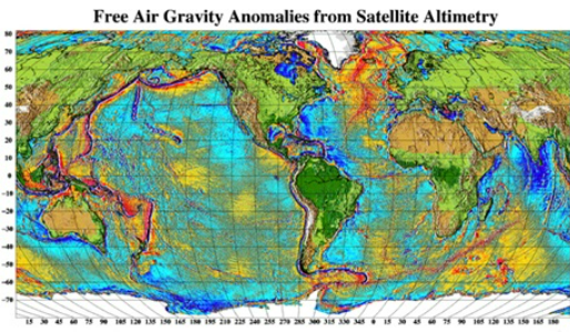
Global Marine Gravity Field Model
The global gravity field model shows the gravity variations over the global ocean as mapped by satellite.
Contact
DTU10 ocean wide gravity field mapped with a resolution of 1 minute by 1 minute corresponding to 2 minute by 2 minute resolution at Equator.
DNSC08 Gravity - PDF presentation / PPS presentation
From DNSC08 to DTU10 - PDF presentation
Download model/data: (DVD-Available on Request – contact: oa@space.dtu.dk)
Author in charge: Ole B. Andersen.
Reference:Please acknowledge any use referencing:
Andersen, O. B., P. Knudsen and P. Berry (2010) The DNSC08GRA global marine gravity field from double retracked satellite altimetry, Journal of Geodesy, Volume 84, Number 3, DOI: 10.1007/s00190-009-0355-9.
Andersen, O. B., The DTU10 Gravity field and Mean sea surface (2010), Second international symposium of the gravity field of the Earth (IGFS2), Fairbanks, Alaska.