New satellite maps the world's forest biomass in 3D with help from DTU
DTU is part of a unique European space project led by ESA, which use new technology to provide a better understanding of how much CO2 the planet’s forests absorb and release. This is crucial in the effort to understand and mitigate global climate change.
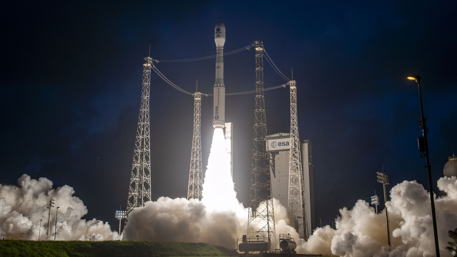
ESA launched the Biomass satellite in April. This week, the first images from the unique mission are being released. Photo: ESA–CNES–Arianespace/S. Martin
Monday 23 June 2025
Morten Garly Andersen
The European Space Agency (ESA) recently launched the Biomass satellite into orbit from Kourou in French Guiana using a Vega-C rocket.
Over the coming years, this European mission will enhance mapping of forest biomass. By converting biomass into carbon, researchers gain insight into forests’ ability to capture, release, and store CO2 from the atmosphere.
This week, the first images from the unique climate mission - contributed to by DTU Space - will be released. This will take place in Vienna from June 23 to 27 at ESA’s Living Planet Symposium on Earth observation from space. See the first Biomass-images here.
“Biomass is a unique mission based on radar technology that has never been used in space. Everything is working as expected so far, and we’re looking forward to seeing the first images from the satellite,” says Professor Jørgen Dall from DTU Space, who leads the Danish contributions to the mission.
Data from Biomass will make it possible to analyse, with high precision, how deforestation contributes to global warming and how reforestation can help mitigate climate change.
The world's forests store 8 billion tons of CO2
Forests play a crucial role in regulating CO2 levels in the atmosphere.
Through photosynthesis, trees convert CO2 from the atmosphere into carbon and oxygen. It is estimated that forests absorb the equivalent of approximately 8 billion tons of CO2 from the atmosphere annually. At the same time, deforestation - especially in tropical areas - releases stored carbon back into the atmosphere as CO2, contributing to the greenhouse effect and thus to global warming.
But there is still considerable uncertainty about exactly how much biomass forests contain - and, consequently, how much CO2 is being absorbed. There is also uncertainty about how forests’ capacity to store CO2 will hold up in the long term under rising global temperatures.
Data from Biomass will be used to provide a more accurate picture.
“The Biomass mission will contribute to an unprecedented level of precision in mapping the world’s forests and their carbon content - especially in tropical regions of South America, Africa, and the Far East, which are the mission’s main focus. These are areas where forests hold large amounts of biomass - and thus store carbon - but where data is currently less accurate,” says Jørgen Dall.
Special radar technology in space for the first time
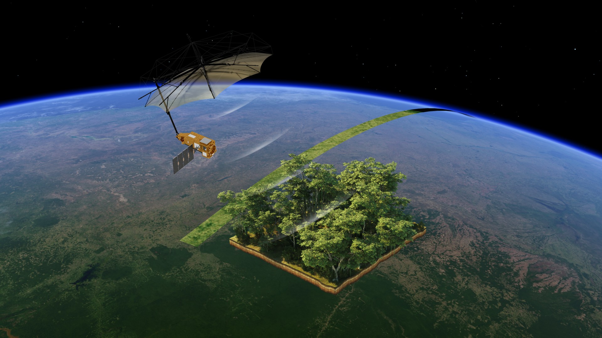
The Biomass satellite orbits 660 km above Earth and uses its advanced radar system to create 3D maps of large forest areas.
The satellite shifts slightly with each orbit, and over nine months, the target forest areas are fully mapped. This can be done in all weather conditions around the clock.
In this way, scientists can gain an overview of the amount and variation of forest biomass and, by extension, carbon content - ultimately providing insights into the role forests play in regulating atmospheric CO2.
“Biomass is fitted with a P-band synthetic aperture radar (SAR). It operates at a low frequency - meaning long wavelengths - which allows it to penetrate forest canopies and measure biomass from top to bottom, unlike higher-frequency radars. This is the first radar of such low frequency ever launched into space,” explains Jørgen Dall.
“The mapping also requires extremely advanced signal processing, which we at DTU Space helped to develop”.
Test flights over Antarctica with similar radar-systems
The Danish contribution focuses, among other things, on calibrating radar signals to ensure the highest possible measurement accuracy. Calibration ensures that the Biomass instruments deliver precise results by adjusting the measurements against known references.
DTU Space has tested and calibrated similar measurement technologies over several years.
“We helped define the calibration methods used to ensure the accuracy of the Biomass radar. Even small inaccuracies can result in large deviations, so the method has been thoroughly tested,” explains Jørgen Dall.
To calibrate the Biomass radar, Jørgen Dall and colleagues previously conducted flights over parts of the Antarctic ice sheet using the Polaris radar, developed by DTU Space in collaboration with ESA.
Polaris is also a P-band SAR system and can simulate the Biomass radar.
The flights were carried out over Antarctica, as its ice sheet provides ideal conditions for calibrating and validating this type of radar system since the radar signals reflect consistently there.
“We have shown that the Antarctic ice sheet is well suited for validating the calibration of a space-based mission. Now the first P-band radar has been launched, and we are excited to see the results,” says Jørgen Dall.
Surveying ice in Antarctica and dried-up riverbeds
In addition to forest biomass mapping, Biomass is also expected to map Antarctic ice masses and ancient, dried-up riverbeds hidden beneath the desert sands in Africa.
This will give researchers data on the Earth’s climate changes over long timescales.
Apart from calibration work, DTU has also contributed with Biomass related airborne measurement campaigns in both the Arctic and Antarctica. And with activities linked to one of Biomass’s secondary goals: mapping Antarctica’s ice sheet, ice shelves, and glaciers.
The first Biomass measurements have already begun, and the first results, apart from the first pictures to be released the coming week, are expected within six months. These space-based measurements will be compared to ground-based measurements from the same regions.
Facts
How Biomass works
The Biomass mission was launched 29 April 2025. It’s a 4-billion DKK European project aimed at improving the mapping of forests' ability to absorb, release, and store carbon from the atmosphere - and hence bind CO2 - via photosynthesis.
The mission is planned to be operational for at least five years.
The radar on the Biomass satellite is a synthetic aperture radar (SAR) with a deployable 12-meter-diameter parabolic antenna. The radar is unique because it operates in the P-band - with a 70 cm wavelength - a much lower frequency than any other satellite-based SAR system. This allows it to penetrate forests from canopy to ground.
Biomass is the first satellite to use SAR tomography and polarimetric SAR interferometry - techniques that combine data from many satellite passes to create 3D maps of forest volumes and forest floors.
The Biomass radar emits an electromagnetic signal from a smaller antenna, which is then reflected off the parabolic dish and directed toward the forest. The signal interacts with various layers of the forest and is reflected back to the satellite with a signature containing information about biomass and forest structure.
When the signal returns to the Biomass satellite, it’s recorded by the onboard computer system, buffered, and then transmitted to Earth. Here, the data is processed to extract parameters such as forest height and biomass, which are then used to model how much carbon trees absorb and thus how much CO2 is stored in forests.
Sources: ESA/DTU Space
The Biomass satellite shifts position slightly after each orbit. Over the course of nine months, it covers the targeted forest areas. This happens in all weather conditions on Earth, around the clock. Illustration: ESA/ATG medialab