National Gravity Networks
Contact
Gabriel Strykowski Senior Scientist gs@space.dtu.dk
National gravity activities of the GEO Gravity Group support Danish authorities in keeping the fundamental geodetic infrastructure of Denmark up to date. The GEO Gravity Group is the only institution in Denmark capable of monitoring, maintaining and modernizing the national gravity networks. In this capacity we act both as advisers and do practical work.
In Geodesy the gravity data are used as input in modelling and improving the national geoid - a national realization of the global geodetic “zero-height-level” surface. Good coverage of the Earth’s surface by gravity data of high quality - both on land and at sea - is required to improve a national geoid model. Furthermore, the quality of the national geoid model depends on broader regional data coverage. Denmark is located just on the edge of area with substantial post-glacial land uplift which clearly affects gravity networks in the neighboring Scandinavian and Baltic countries. Although monitoring timewise change of gravity data is less severe in Denmark it nevertheless conforms to joint regional data standards by Nordic Geodetic Commission, NKG (Nordiska Kommisionen för Geodesi) – a regional organization coordinating this work.
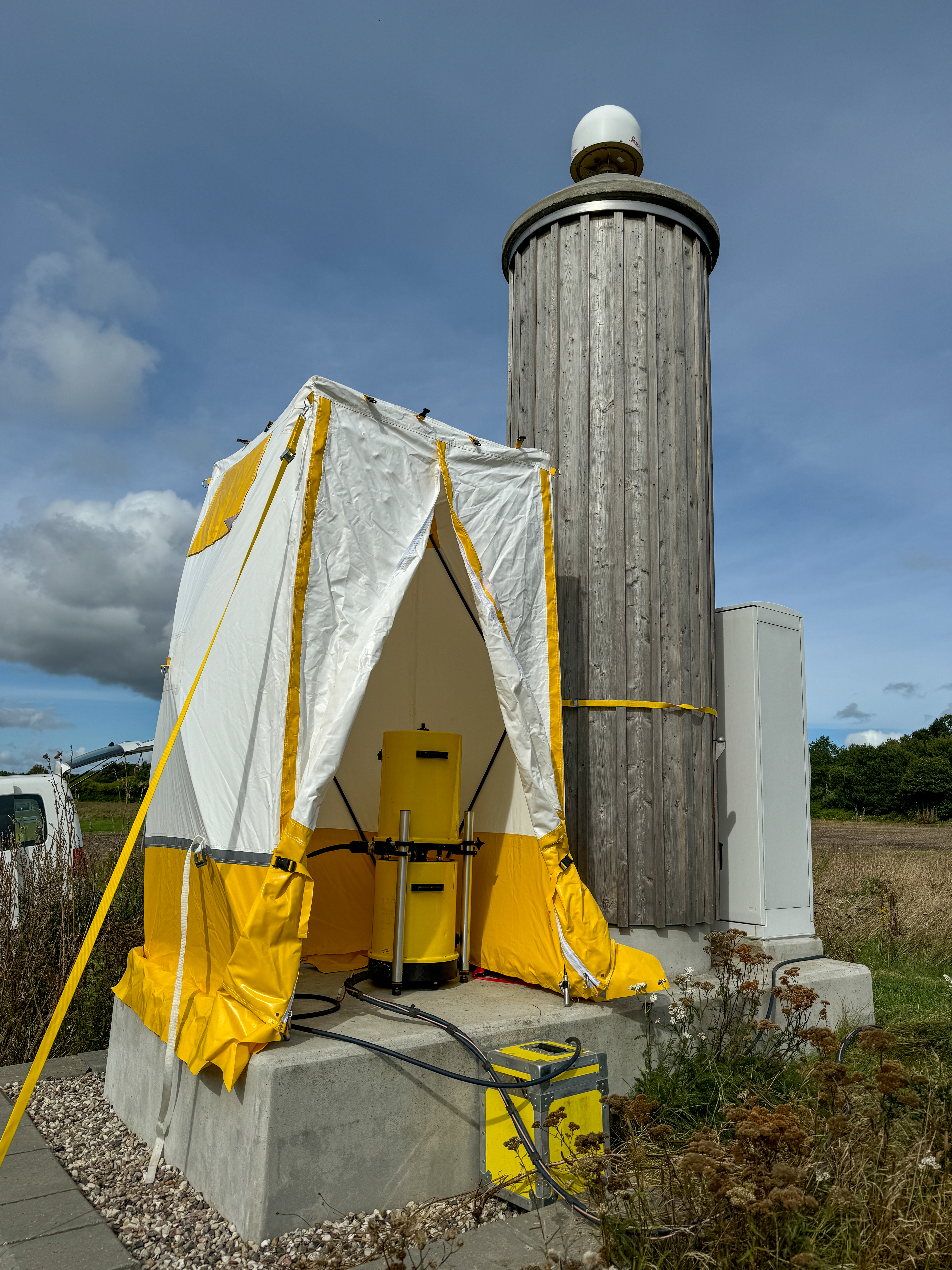
Stations of precise gravity network in Denmark collocate often (but not exclusively) with Danish GNSS CORS stations so that measured gravity change can be correlated with corresponding height change. Gravity data of such highly controlled precise gravity network serves as robust high-quality reference for relative gravity measurements; relative gravimetry. We use relative gravimetry for quality assessment of dense gravity data set (of different vintage) of detailed gravity network by revisiting a selected subset of these stations with modern instruments. This dense data set is used in practice for computations of the national geoid model. Relative gravity measurements are also used to acquire new data e.g. to fill-in data voids in surface data coverage and/or to provide reference base stations in harbors and airports for marine gravimetry or airborne gravimetry. Furthermore, we do relative gravity measurements on 5D points – a physical geodetic network of stations used for national levelling. Gravity measurements on these 5D points should make it possible, in case of misalignment between the GNSS-leveling geoid and gravimetric geoid, to diagnose the reason of the misalignment.
The same gravity data can be used in Geophysics/Geology to map structures in the subsurface, e.g. in connection with seismic data.
