Satellite magnetometry and Swarm DISC
")
Exploring Earth’s magnetic field from space:
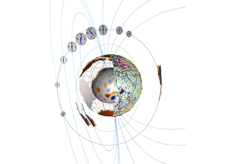
Magnetic data taken by polar-orbiting satellites is the only way to obtain truly global coverage of magnetic observations. Based on more than three decades experience with dedicated high-precision magnetic satellite missions like Ørsted, CHAMP, and now Swarm, we study the spatial structure of the various contributions to Earth’s magnetic field (in the core, crust, ionosphere, and magnetosphere as well as induced contributions in the mantle) and their temporal behaviour.
The objective of the Swarm satellite trio is to provide the best ever survey of the geomagnetic field and its temporal evolution, in order to gain new insights into the Earth system by improving our understanding of the Earth’s interior and its environment. Launched in November 2013, the mission comprises three identical satellites, two of which fly side-by-side at low altitude (initially 450 km), and a third higher satellite at 530 km altitude.
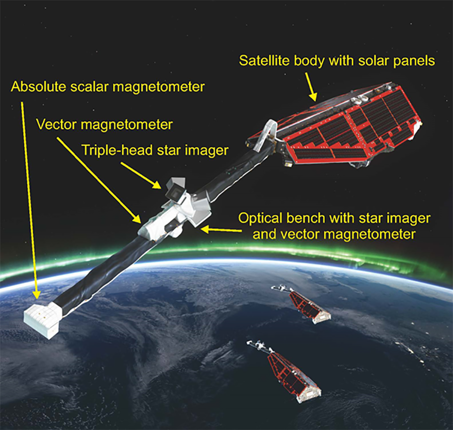
High-precision and -resolution measurements of the strength, direction, and variation of the magnetic field, complemented by precise navigation, accelerometer, electric field, plasma density, and temperature measurements, provide necessary observations to separate the various contributions to the geomagnetic field. This results in a unique “view” inside the Earth from space.
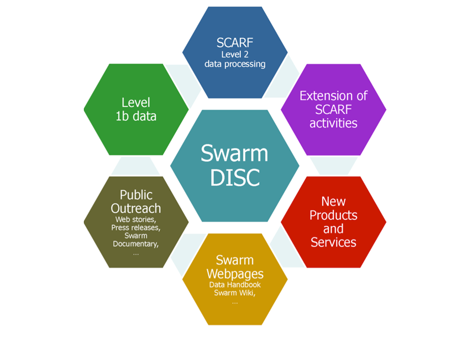
The Swarm mission has been proposed to ESA by a European consortium led by DTU Space. Today DTU Space leads the Swarm DISC (Data, Innovation, and Science Cluster), an international consortium comprising 28 partners in Europe, Canada, and the US to enhance the scientific return of the Swarm satellite mission. The tasks of the Swarm DISC include processing and dissemination of Swarm data products, communication activities, as well as identifying, selecting, and running projects as part of the activity New Swarm Products and Services.
Scientists at the Division of Geomagnetism and Geospace use Swarm magnetic satellite data for modelling the geomagnetic field. Read more here: Earth-physics-and-machine-learning
The CHAOS geomagnetic model series is internationally recognised as one of the best models of the various sources to Earth’s magnetic field.
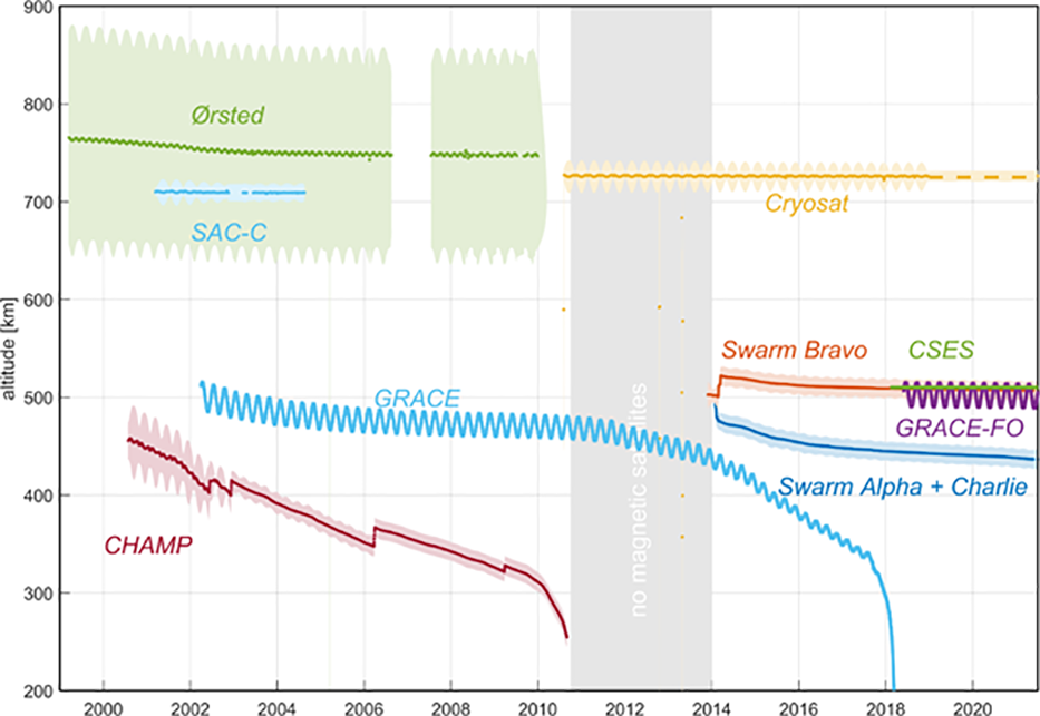
Data mining: In addition to magnetic measurements obtained by dedicated satellite missions like Ørsted, CHAMP and Swarm we also work with data from “navigational magnetometers” onboard satellites like CryoSat-2 and GRACE, as part of their AOCS (Attitude and Orbit Control System). After careful calibration and processing these data are a useful supplement to those of dedicated satellite missions for investigating processes in Earth’s interior and its environment. Our pioneering work in deriving algorithms for calibrating data from “navigational magnetometers” and their application to satellite like CryoSat-2, GRACE, and GOCE has stimulated other groups to use similar schemes for calibrating e.g. platform magnetometer data of GRACE-FO and DMSP.